TRADECRAFT: Geolocation Basics
The Concept
Geolocation is the art of finding exactly where a photo was taken using only the visual clues inside the image. You don’t need to be a genius; you just need to play a game of “Elimination.”
THE METHOD: “Look Up, Look Down”
Start with the things that cannot move.
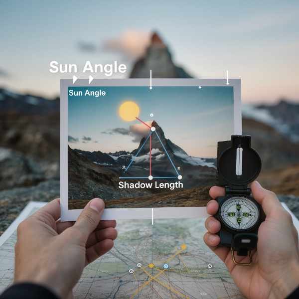
1. The Sky (The Sun & Weather)
-
Shadows: If the shadows are short, it is noon. If they are long, it is morning/evening.
-
Satellite Dishes: In the Northern Hemisphere (USA/Europe), satellite dishes usually point South (towards the Equator). In the Southern Hemisphere, they point North. This instantly gives you a compass bearing.
2. The Ground (Infrastructure)
-
Plugs: Look for power outlets. Three prongs (UK)? Two flat pins (USA)? Two round pins (Europe)?
-
Road Lines: Yellow center lines = Americas (mostly). White center lines = Europe/Rest of World.
-
Driving Side: Are the cars on the Left (UK, Japan, Australia) or Right (USA, Europe)?
3. The Flora (Plants)
-
Palm Trees: Tropical.
-
Pine Trees: Temperate/Cold.
-
The “Birch” Rule: Specific trees only grow in specific latitudes. Use Google Lens on the trees in the background, not just the people.
LAB EXERCISE: The “Where Am I?” Game
Task: Go to GeoGuessr.com (Free version).
-
Play one round.
-
Don’t Guess: Before you click the map, force yourself to find three pieces of evidence:
-
A language on a sign.
-
The side of the road cars are driving on.
-
The type of landscape (Desert? Forest?).
-
-
The Result: See how much closer you get when you stop guessing and start analyzing.